
Why high definition mapping remains vital for navigation
Anúncios
High definition mapping provides the centimeter-level spatial precision required by modern autonomous vehicles and advanced driver assistance systems in 2026.
Traditional GPS routing tools only offer general road coordinates, leaving automated driving computers blind to exact lane markings, complex intersection geometry, and roadside barriers.
Automotive engineers recognize that artificial intelligence perception algorithms alone cannot anticipate hidden road curvatures without hyper-accurate digital cartography backing them up.
Anúncios
This sophisticated technology forms the invisible digital foundation supporting next-generation transportation safety worldwide.
Navigating this intricate technical landscape requires examining how LiDAR point clouds and real-time cloud updates redefine vehicle localization accuracy.
Autonomous developers rely on these hyper-detailed datasets to eliminate human driving errors across congested metropolitan highway networks.
Think of high-precision maps as an intricate digital sheet music sheet guiding an orchestra through a complex symphony. Are you ready to discover how centimeter-level digital blueprints safeguard future roadways?
Navigating Precision Cartography Innovations
- Investigating LiDAR point cloud integration and centimeter-level road geometry modeling.
- Analyzing real-time cloud data updates for dynamic construction zone awareness.
- Evaluating autonomous vehicle localization redundancy against sensor occlusion hazards.
- Measuring economic impacts of HD cartography investments across global automotive fleets.
What Makes Centimeter-Level Cartography Essential for Autonomous Vehicles?
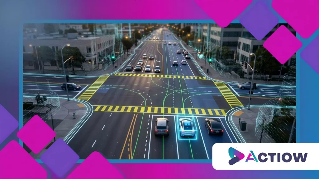
High definition mapping delivers unmatched spatial accuracy by charting individual lane dividers, traffic sign elevations, and curb heights down to exact centimeters.
Autonomous vehicles moving at highway speeds cannot rely solely on onboard cameras when blinding rainstorms or glaring sunlight obstruct optical sensors.
Think of navigating a dense fog without radar as driving blindfolded; HD map data acts as your permanent spatial memory.
Industry research published by the Society of Automotive Engineers confirms that redundant map data reduces autonomous navigation errors by over sixty percent.
Vehicle perception systems cross-reference live camera feeds with pre-recorded map coordinates to confirm exact lane positioning instantly in complex urban environments.
When heavy snowfall buries painted asphalt lines under a blanket of white, precise digital boundaries keep automated steering systems safely centered.
This dual-layer redundancy prevents catastrophic trajectory miscalculations on high-speed interstate corridors. Advanced safety engineering depends entirely on absolute geographical certainty.
How Do LiDAR Point Clouds Capture Road Geometry?
Mobile mapping vehicles equipped with spinning LiDAR sensors sweep laser beams across surroundings to generate hyper-dense three-dimensional point clouds of highways.
These detailed point clouds record exact physical dimensions of overhead bridges, guardrails, and lane widths with millimeter precision.
++ The Best Apps to Learn How to Drive
Why Are Optical Cameras Insufficient Alone?
Camera sensors suffer severe performance degradation when exposed to blinding glare from low-angle sunset light, dense fog, or heavy downpours.
Relying exclusively on real-time optical recognition leaves self-driving computers vulnerable to unexpected sensor blindness hazards.
Also read: How Solid-State Batteries Could Change Electric Cars in 2026
How Does Absolute Localization Prevent Wandering?
Absolute localization anchors vehicle coordinates to fixed physical infrastructure stored in digital databases rather than temporary visual markers.
This fixed referencing ensures autonomous cars maintain precise trajectory discipline through confusing multi-lane highway interchanges.
How Do Real-Time Cloud Updates Keep Digital Maps Accurate?
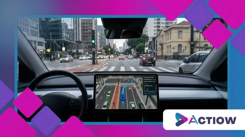
High definition mapping systems constantly ingest millions of crowdsourced telemetry data points from connected car fleets to update dynamic road changes immediately.
When municipal crews alter lane configurations or construct temporary work zones, passing connected vehicles upload these physical alterations to cloud servers.
Imagine a living digital organism that heals and updates its own neural pathways the moment an obstruction occurs.
This continuous feedback loop ensures autonomous driving algorithms never act upon outdated geographical information.
Automotive data analytics reports indicate that modern connected vehicle fleets process petabytes of environmental telemetry daily to maintain absolute map freshness.
Cloud servers filter these crowdsourced updates and distribute corrected routing vectors to millions of active vehicles within minutes.
When road infrastructure evolves, your vehicle’s digital memory adapts synchronously. Real-time connectivity bridges the gap between static cartography and chaotic physical reality.
Read more: How digital rearview mirrors Improve Visibility in Traffic
What Role Do Crowdsourced Sensor Feeds Play?
Every connected vehicle equipped with modern ADAS sensors acts as a mobile data collection node, reporting unexpected potholes and lane shifts automatically.
Crowdsourcing eliminates the massive financial overhead of deploying dedicated survey fleets for continuous road monitoring.
How Fast Are Dynamic Construction Zones Synchronized?
Cloud infrastructure processes incoming vehicle telemetry algorithms to verify temporary construction barriers and broadcast corrected vector paths across regional networks instantly.
Drivers and autonomous systems receive rerouting warnings before approaching work zones.
Why Is Map Staleness Dangerous for Automation?
Relying on stale, un-updated digital maps causes autonomous vehicles to execute maneuvers based on non-existent lanes or vanished off-ramps.
Maintaining real-time cloud synchronization guarantees absolute operational safety across changing municipal landscapes.
What Are the Core Structural Differences Between Standard GPS and HD Maps?
High definition mapping surpasses consumer navigation apps by providing comprehensive multidimensional blueprints rather than simple two-dimensional route lines and turn instructions.
Standard GPS systems guide human drivers from city to city, whereas HD maps guide automated computers through individual lane meters.
Think of standard GPS as a regional pilot’s paper flight chart, while high-definition cartography functions as an automated landing system.
Comparative automotive research demonstrates that autonomous level-three and level-four systems cannot function safely without this granular infrastructure data.
Engineering teams design these advanced databases using specialized multilayered architecture that separates static road geometry from dynamic traffic sign updates.
This modular structure allows autonomous vehicle processors to query specific spatial attributes without wasting computational bandwidth on irrelevant scenery.
When computing efficiency matches spatial accuracy, vehicle reaction times drop to milliseconds. Superior digital architecture ensures flawless autonomous execution.
How Do Multilayered Databases Optimize Processing Speeds?
Multilayered mapping architectures separate permanent physical road structures from transient traffic data, allowing onboard computers to query relevant spatial attributes rapidly.
This intelligent data partitioning minimizes CPU latency during high-speed driving maneuvers.
Why Do Autonomous Systems Require Elevation Data?
Precise elevation and road grade measurements allow self-driving trucks to calculate optimal braking distances and energy regeneration profiles in advance.
Knowing whether an approaching highway segment slopes upward or downward prevents harsh mechanical adjustments.
How Does Vector Precision Eliminate Navigation Ambiguity?
Vector-based HD maps define exact polygon boundaries for crosswalks, stop lines, and median strips, eliminating interpretive ambiguity for artificial intelligence vision models.
Clear mathematical boundaries ensure predictable vehicle behavior in chaotic traffic.
Automotive Navigation Technology Comparison Matrix
The structured table below contrasts standard GPS consumer navigation with advanced high-definition mapping architectures across key performance metrics.
| Navigation Dimension | Standard Consumer GPS Routing | Advanced High-Definition Mapping |
| Spatial Precision | General road coordinates (approx. 3 to 5 meters) | Centimeter-level accuracy (approx. 10 to 20 centimeters) |
| Data Attributes | Route lines, traffic delays, and point-of-interest search | Lane dividers, curb heights, sign elevations, and barriers |
| Update Frequency | Periodic bulk map downloads (weekly or monthly) | Real-time cloud synchronization via connected vehicle fleets |
| Primary System User | Human drivers requiring general destination directions | Autonomous driving computers requiring exact trajectory control |
Ensuring Absolute Safety on Future Autonomous Roadways
High definition mapping remains an irreplaceable technological pillar guaranteeing the safe, efficient rollout of autonomous transportation across global highway networks.
By combining centimeter-level spatial precision with real-time cloud updates, modern cartography empowers vehicles to navigate complex environments flawlessly.
Embracing this advanced infrastructure ensures our roads become exponentially safer for every commuter.
Take a moment to evaluate how digital navigation tools impact your daily commute this week. How do you envision automated mapping transforming your local transit infrastructure? Share your experience in the comments below!
Frequently Asked Questions
Can standard GPS replace high-definition maps for autonomous driving?
No, standard consumer GPS lacks the centimeter-level spatial precision and lane-level geometry required by automated driving systems to maintain safe trajectory control.
How often do automotive high-definition maps receive updates?
Connected vehicle fleets upload environmental telemetry continuously, allowing cloud servers to push real-time map corrections to active vehicles within minutes.
Do high-definition maps function effectively during heavy snowstorms?
Yes, because HD maps store permanent physical infrastructure coordinates like curbs and barriers, vehicles maintain safe positioning even when snow covers painted lane lines.
What is the financial investment required to build HD maps?
Building comprehensive HD map coverages demands significant capital investment in mobile LiDAR survey fleets, cloud infrastructure, and advanced data processing algorithms.
How do autonomous trucks utilize elevation data from HD maps?
Autonomous heavy trucks leverage precise grade measurements to optimize fuel efficiency, predict braking requirements, and manage electronic powertrain torque delivery smoothly.